You've got two choices when doing a tubewalk: you can follow one of my walking routes, in which case I hope you enjoy yourself, or you can design your own walk, in which case you might find the following tips useful.
The first step is to decide which stations you're going to walk between, and the second step is to design a route that joins those stations together while weaving through the places you want to visit en route. As I designed my tubewalk, I slowly added points of interest to each section, and I have to say I really enjoyed the process. I originally designed my route to go via as many interesting spots as I could find, meandering around through suburban parks, along urban rivers, past the sites of historical events and past as many famous landmarks as I could cram into a sensible day's walk; but it was only when I started annotating my route maps that I started getting properly excited, because that's when it dawned on me just how interesting tubewalking can be. In London, there are fascinating stories every few yards, and that's just one reason why urban walking is refreshingly different from walking in the countryside.
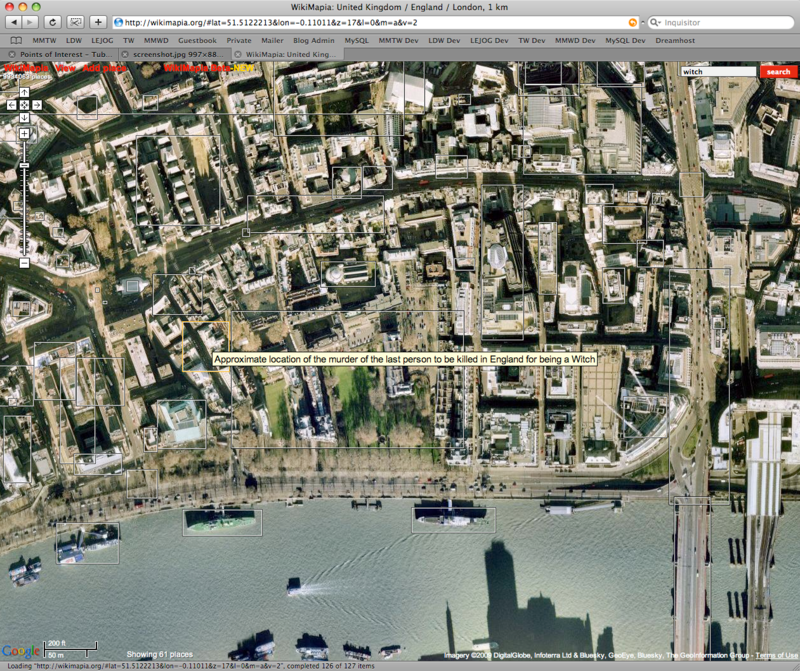
Part of the reason I discovered so much about London was my discovery of Wikimapia. This wiki-powered site shows a Google map of the world that visitors can mark up with information showing what the buildings in the map actually are. It's particularly good in central London, where you can simply hover your mouse over the satellite images to find out the names of buildings, rivers, pubs and a whole lot more. The database is, of course, far from complete and it isn't always 100 per cent accurate, but there is a huge amount of information in there already, and without it I wouldn't have had a clue that my route took me past the sites of four Jack the Ripper murders, the world's first Tesco store, and the London residences of Elton John and the late Freddie Mercury (to name just a few – check out my list of interesting points for more).
Also invaluable during the planning process was Multimap, whose maps contain more place names than any others that I've found. Multimap is particularly good on the names of parks and recreational grounds, and it's much better than Google Maps at showing footpaths (though its satellite shots are pretty poor, so Google still wins there). Add in the maps and guidebooks I bought at the start of the project, and I had access to a massive amount of information about where I was planning to walk. Armed with this sort of information, you should be able to weave your tubewalks through the areas that pique your interest...